Westminster Bridge Mill, Westminster
A steam-powered corn mill in the historic county of Surrey, England.
See related images and documents.
See images only.
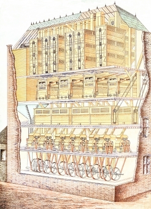
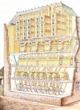
Originally a stone grinding mill, 11 of the 20 stones were replaced by a steam powered roller plant. The mill appears to have been demolished by 1914 as it is no longer shown on the 1914 revision of the OS map (published 1935).
Full details
| Power source | Steam |
| Mill type | Roller flour mill |
| Mill function | Corn mill |
| Archive ID | 12620 |
| Location | Westminster |
| Historic county | Surrey |
| Country | England, United Kingdom |
| NGR | TQ 3063 7970 |
| Latitude/longitude | 51.50098025, -0.11980635 |
Location
Gallery
References
- Ordnance Survey 25 inch map, London (1915- Numbered sheets) V.14 (1935)
- Ordnance Survey 25 inch map, London (First Editions c1850s) XLIV (1879)
- Watts, Martin & Sue, From quern to computer: The history of flour milling (2016), chapter 10
Missing information? Click here to tell us about this mill.


