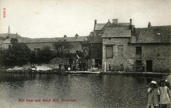
Higher Mill, Ulverston
A water-powered corn mill in the historic county of Lancashire, England.
See related images and documents.
See images only.
Shown as a brush factory on the 1895 (surveyed 1888 to 1889) map.
Full details
| Alternative names | Ure Mill |
| Power source | Water |
| Mill type | Watermill |
| Mill function | Corn mill |
| Archive ID | 3792 |
| Location | Ulverston |
| Historic county | Lancashire |
| Country | England, United Kingdom |
| NGR | SD 284 790 |
| Latitude/longitude | 54.20230000, -3.09850000 |
Location
Gallery
References
- Anthony Bryan, Mills Research Group Database
- Bennett, John & Jan, A guide to the industrial archaeology of Cumbria (Association for Industrial Archaeology, 1993), p. 39
- Ordnance Survey six-inch map, Lancashire XVI (1850)
- Ordnance Survey six-inch map, Lancashire XVI (1895)
Missing information? Click here to tell us about this mill.


