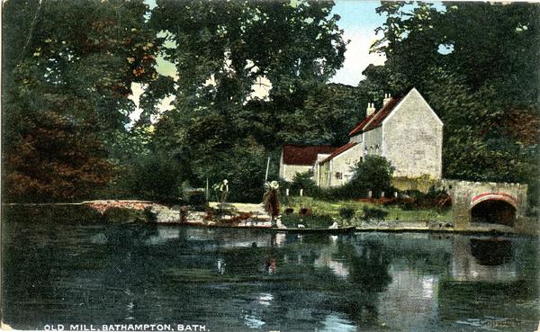
Bathampton Mill, Bathampton
A water-powered corn mill in the historic county of Somerset, England.
See related images and documents.
See images only.
The mill was disused by the time of the 1904 OS map. It later became a pub.
Full details
| Power source | Water |
| Mill type | Watermill |
| River | Avon |
| Mill function | Corn mill |
| Archive ID | 14371 |
| Location | Bathampton |
| Historic county | Somerset |
| Country | England, United Kingdom |
| NGR | ST 774 668 |
| Latitude/longitude | 51.40065000, -2.32542100 |
Location
Gallery
References
- Ordnance Survey 25 inch map, Somerset XIV.2 (1904)
- Ordnance Survey 25 inch map, Somerset XIV.2 (1888)
Missing information? Click here to tell us about this mill.


